Controlling Steep Slope Development

By Bill Moore
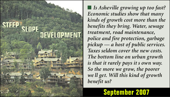
“Steep slopes” are designated as those areas at or above 2,200 feet elevation above mean sea level and having an existing grade of 15% or more.
There has
been much discussion of late surrounding the issue of steep slope
development in the Asheville area. This is, for many in the area, a
vital and often emotional debate pitting conservation activists against
city planners and potential developers. Citizens and other interested
parties have and will continue to have important input into this
process. So far, some of the most pressing concerns as voiced by locals
seem to focus on erosion control and run-off, preservation of existing
vegetation, construction density, limits on grading and the possibility
of landslides.
 |
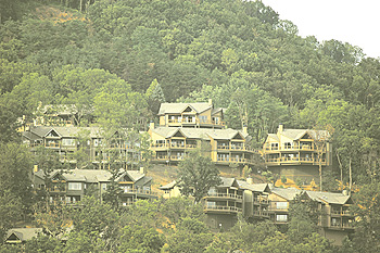
| We cannot afford to lose our ridge tops and slopes. Is it time for a temporary break from the rapid pace of large-scale development? Photo by Renato Rotolo |
Other continuing
concerns include over development, a decrease in property available
with mountain views, how to balance aesthetics with the legitimate
needs of the tourism industry, and of course respect for the
sensibilities of those whose families have been in these mountains for
generations. This is obviously a tall order, but the Asheville Planning
and Development office, at the direction of the mayor and council, has
begun a process to address at least the technical demands of steep
slope development.
Shannon Tuch, Assistant Director of Planning and Development for the
City of Asheville discussed with Urban News staff the on-going need for
strengthening steep slope standards, a process begun in the 1980s. As a
result, after much staff time and public input, the Asheville City
Council, on July 10, 2007 adopted an amendment to section 7-12-4,
commonly referred to as the “steep slope” or “hillside” development
standards. According to the amendment, “steep slopes” are designated as
those areas at or above 2,200 feet elevation above mean sea level and
having an existing grade of 15% or more. In order to determine specific
development standards steep slope areas have been separated into
different zones.
Zone “A” includes areas between 2,220 and 2,349 feet, while zone “B”
would include areas at or above 2,350 feet. Zone “A”, by virtue of its
lower elevation, would allow greater leeway for grading, up to a
maximum of 80% onsite grading on an existing grade of 15% to 19%. On
site grading would decrease by 10% at a time for existing grades up to
29%. From existing grades of 30 to 40+%, even less site grading would
be allowed. Area “B” site grading requirements would be even more
stringent because of the higher elevations with no more than 45% site
grading on existing grades of 15 to 19%, and no more than 15% site
grading on existing slopes of 40+%.
With regard to existing vegetation, the amendment is quite specific.
Any native trees six or more inches in diameter and at least chest high
as well as any mature grouping of mountain laurel or rhododendron 250
square feet of area or larger would be protected if at all feasible.
Any invasive non-native species would not be included. For any new
development or additions, these preservation areas would have to be
designated on plans submitted for approval.
Existing development would require other methods such as aerial
photography to determine the extent of tree cover required and how best
utilized. Under this provision, trees would require protective fencing
whether the development was new or existing if further work was planned
at a later date. Fines will be levied for removal, without prior
written approval, of vegetation not determined to be either dead or a
threat to safety.
Residential density is also addressed by this amendment and requiring
reduction of residential development in the steep slope areas
designated at the elevations provided in areas “A” and “B.” Other
specifics elements proposed for regulation under this amendment also
include road construction, development intensity, structure height and
depth, artificial slopes and alternative landscape planning.
Perhaps the most critical provision of the amendment is the requirement
for a geotechnical analysis on any natural grade of 36% or higher, or
on properties located in areas designated as High Hazard or Moderate
Hazard on the Buncombe County Slope Stability Index Map. Under this
provision, the North Carolina Geological Survey would require a North
Carolina registered professional engineer to determine the underlying
stability of a sites geology and soil before any development activity
could begin.
The thrust of this amendment, and all the forgoing, is the end result
of an amalgam of public demand and technical requirement. If
successful, among others, the goals and objective of this amendment
will promote public safety by ensuring that development on steep slopes
and ridge top areas is effectively addressed and will also promote the
limitation of sedimentation and erosion, both dangerous to people,
wildlife and vegetation as the citizens of California discovered
through a series of tragic landslides a while back. Lastly, in the
wording of the goals and objectives, the amendment aims to preserve
scenic views and vistas that are inherent to Asheville’s character.


